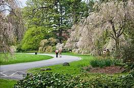
 Planting Fields State Park
Long Island, NY has 26 state parks.

East Hampton Coastline
Long Island's picturesque coastline is 1,180 miles long.
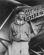
Charles Lindbergh and the Spirit of Saint Louis
Charles Lindbergh began his famous non-stop flight from New York to Paris from Long Island's Roosevelt Field airstrip in the early morning of Friday, May 20, 1927.

The Apollo Lunar Module (LM) that landed on the moon was built in Long Island, NY by Grumman Corp.
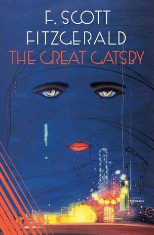
F.Scott Fitzgerald wrote the Great Gatsby (which described Long Island's "Gold Coast") while living in Great Neck.
The Vanderbilt Planetarium, located in Centerport, NY is one of the largest and best-equipped in the United States.
The Long Island Railroad provides more than 303,000 rides to customers each weekday.
Long Island, NY has several national award-winning schools including more than 14 leading colleges and universities.
Long Island has world leaders in biotechnology.
Long Island has leading research and world-renowned hospitals.
Until next time. Stop and smell the roses.
Rosalinda, "The Rose Lady "